 |
| The Boulders |
I had a hunch that Brian might be in for a climb so I put
the bait out there on Facebook and he bit the line. We didn’t have much time to
plan and look into weather and conditions, so we decided to stick to the oxygen
laden peaks of the Boulder Flatirons. In
the fall we had tried this route, but halfway up the mountain the trail was
closed and we were forced to abort. I
checked online and the trail was open so we were a go for South Boulder Peak
and Bear Peak.
 |
| South Boulder Peak |
Brian found a route that has a nice loop of the two peaks so
that was our plan. About 9am we were off
on the approach from South Mesa TH.
Beware this is a fee area so bring $5.
There was a nice snow/ice covering from the parking lot and soon after
crossing the creek we could see a few trail closures.
\
We stuck to the west ridge trail called the Homestead Trail for our ascent. This is a gradual rising trail that after about 1.5miles meets up with the South Shadow Canyon Trail. The South Shadow Canyon Trail is more of a road than a trail, but it doesn’t last too long, probably about a mile till connecting to the true Shadow Canyon Trail. Lucky for us the sun was out melting all the snow off the trees and giving me a nice morning shower. It was quite odd, but it wasn’t cold so that was nice.
We stuck to the west ridge trail called the Homestead Trail for our ascent. This is a gradual rising trail that after about 1.5miles meets up with the South Shadow Canyon Trail. The South Shadow Canyon Trail is more of a road than a trail, but it doesn’t last too long, probably about a mile till connecting to the true Shadow Canyon Trail. Lucky for us the sun was out melting all the snow off the trees and giving me a nice morning shower. It was quite odd, but it wasn’t cold so that was nice.
 |
| Bear Peak |
I’m not sure on the exact mileage and gain but a rough
guestimation of the Shadow Canyon Trail is about 1.5miles and 1,600ft. So there is a steady grade, but the canyon is
pretty cool. The lower section is all
covered in trees, very green and had some sweet geology. Soon you will find out where Boulder got its
name, there are huge boulders all along the trail. Anyone that is into geology will have a fun
experience looking at the different rock types and weathering patterns, so head
up there if you haven’t yet. I may have
even discovered a dinosaur bone in a large sedimentary boulder. I am going to have one of my professors
confirm that though.
Once you make it to the fire line that means the saddle is
close. And this is the best area to find
the mineral orthoclase if you’re looking for a good specimen for your
collection. I got a few pieces that I’m
pretty excited about.
 |
| Bear Peak Ridge Looking into Boulder |
At the saddle we turned south towards South Boulder Peak and
about half mile and 300ft will put you up on the rocky summit. This was all on a trail, mostly covered in
snow and ice so some traction like micro spikes are recommended. We didn’t take too long on the summit since
we were heading over to Bear Peak next.
It is probably a mile in-between the two peaks with a loss of
300ft and a gain of 200ft or so along a trail.
There is a short rocky ridge, basically the top edge of a flatiron you
get to scramble over for about a hundred feet which will be the excitement of
the day. Boulder looms below and there
are some great lounging rocks at the summit.
After enjoying my PB&J it was time to head down. We took the north ridge on Fern Canyon
Trail. This was quite steep and covered
in snow and ice. I don’t think this
would be wise without traction, so put on your spikes. The drop is quite quick and I was glad to be
going down rather than up at this point.
After converging with the saddle you start heading down a bunch of tight
switchbacks then into a tight canyon similar to Shadow Canyon. This goes for what seemed forever since I
took off my spikes on a long dirt section, then the ice came back and I was too
lazy to dig them out again. So it was
careful steps for close to a mile.
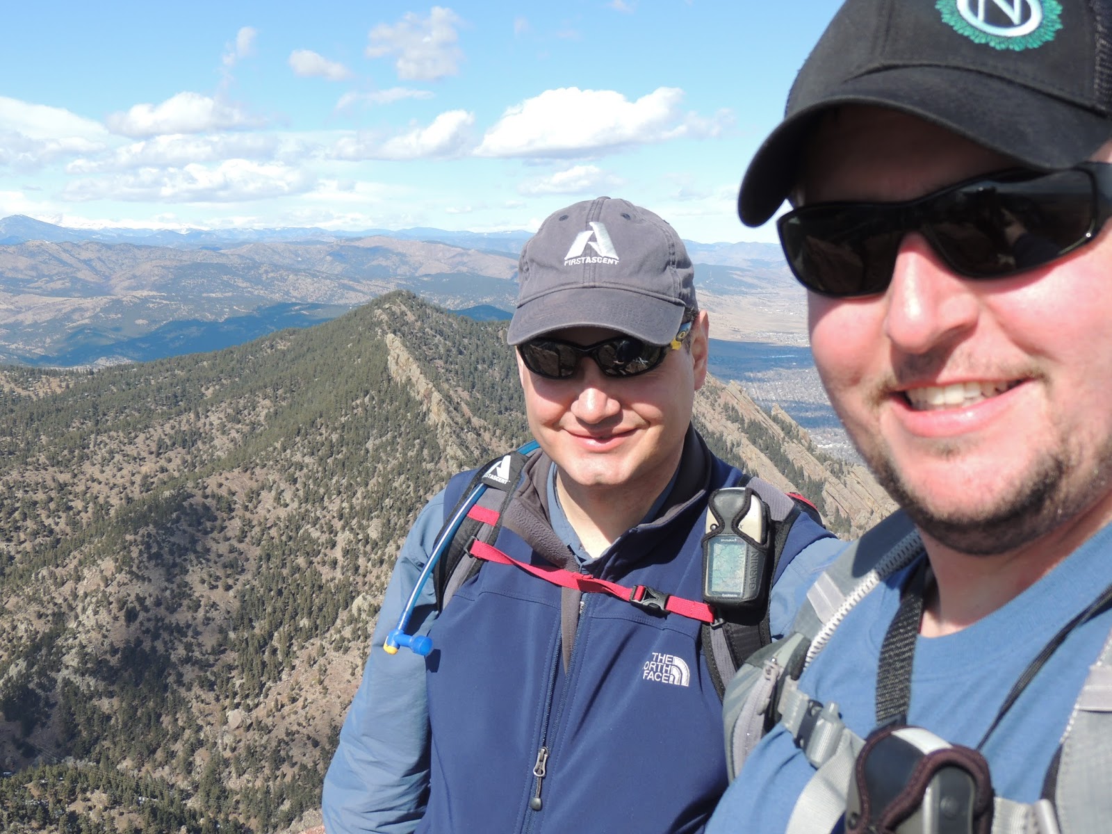 |
| Me and Brian on the Summit |
It turned out to be exactly a 10 mile loop. This could be shortened by about 2 miles by
just descending the Shadow Canyon trail rat
her than doing the loop. It’s not a bad hike though, I found it enjoyable even in the mud and muck. The parking lot didn’t have a sign of snow like the morning. It all melted out and left a nice mud bowl though.
her than doing the loop. It’s not a bad hike though, I found it enjoyable even in the mud and muck. The parking lot didn’t have a sign of snow like the morning. It all melted out and left a nice mud bowl though.
This will be the last climb Brian and I do for a while since
he is moving to California. I’m glad we
were able to sneak it in and get a 2fer in the process. It was a great day, just like every day in
the mountains.
 |
| GPS Track |
TH Elevation: 5,633ft
South Boulder Peak Summit: 8,524ft
Bear Peak: 8,458ft
Total Gained Elevation: 3,250ft
Class: 2
Distance: 10 miles
Time: 5:10 moving, 2:15 stopped.
Climbing Partner: Brian
Picture Link: https://plus.google.com/u/0/photos/115877356129727775322/albums/5987063500617973969