Friday, June 28, 2013

Gray Wolf Mountain and Mount Spalding


On Thursday night I finished one of my summer classes, so what sounded good was a nice hike in the Colorado Mountains.  I wanted to do something that would be short so I offered the idea of Gray Wolf and Spalding to Brian and he was in.  This combo is started from the Summit Lake TH on the Mount Evans Road.  I know the TH is at 12,850ft over 600ft taller than the highest peak in Idaho, but it is a TH so it counts! Hahaha.
We met at 7am and were on the trail climbing a little after 8am.  The parking lot was already full by this time, so you got to get up here early if you don’t want to park on the road.  There is a clear trail leading to the summit of Spalding.  It is a trail, but at times will include a little climbing.  We saw one of the most impressive things ever today as we were coming down.  There was a group of about eight people and one of the individuals was a blind man.  It was amazing watching him work his way up the route.  This is not a cup cake trail, I can’t imagine the guts it would take to do such a thing, and needless to say I was very impressed and happy to see this.
Evans, Spalding, and Bierstadt
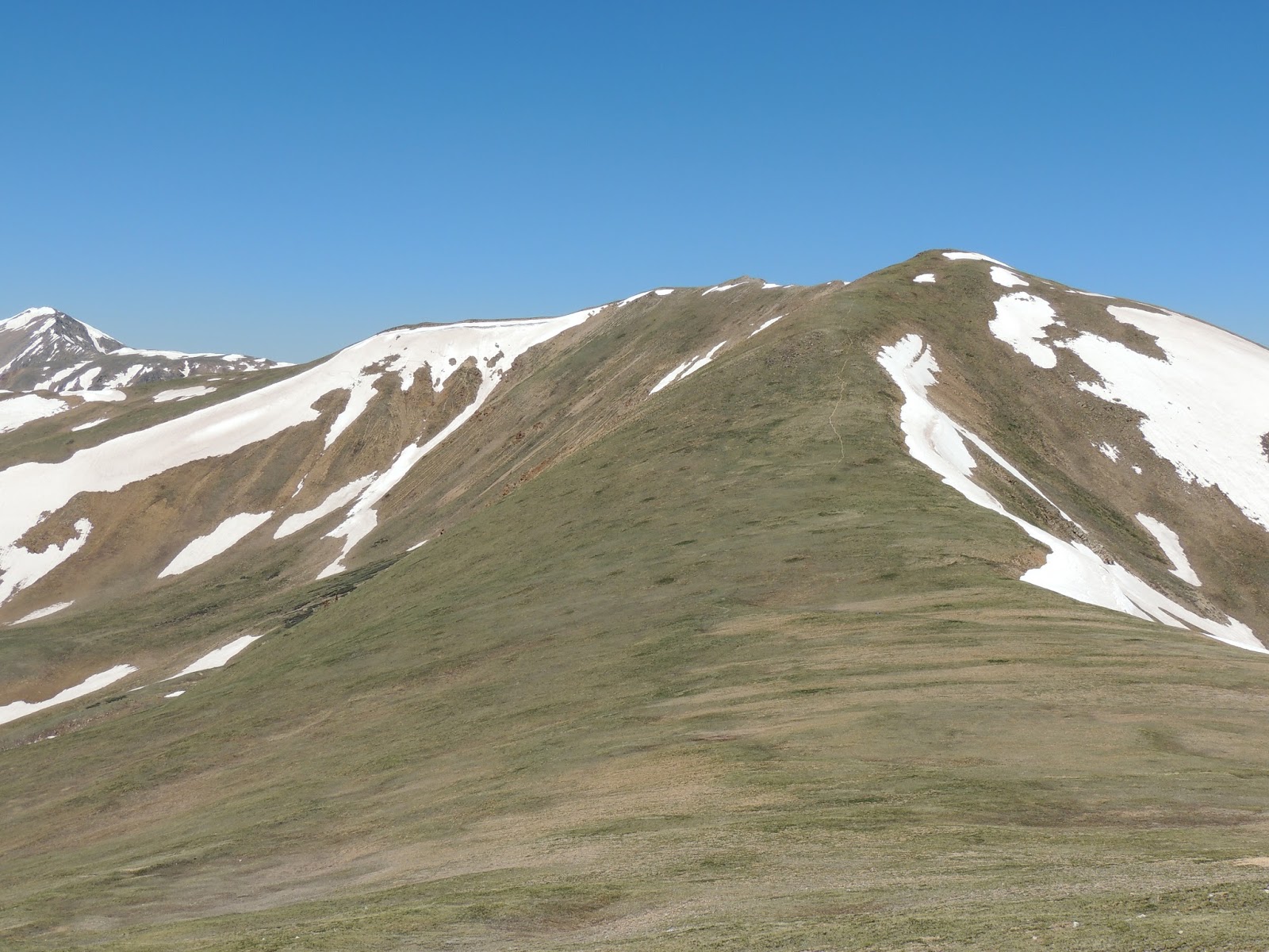
After we made it over the last gully and hundred or so feet below Spalding’s summit, we cut cross country on the way to Gray Wolf Mountain.  The walk down wasn’t so bad, mainly on large boulders buried in the grass so nothing was moving around.  When we got into the open space in-between the mountain the mush of recent snow melt was in ample supply.  I just kept moving to get across what seemed miles to the other side at the base of Gray Wolf.  There was only about 100ft up to the summit, but I pulled out a snack and took in the view anyway.  It was a new perspective for me seeing Evans, Spalding and Bierstadt from the North.  I gobbled down a candy bar as it melted in my hand, way to hot outside today then made my way up the last little bit of Gray Wolf.  The summit area was huge and probably doesn’t get too many visitors.  We noticed thunderheads building on the south side of Evans so we didn’t hang out long.  It was around 10am now and thought we should hustle over to Spalding before the afternoon storms came in.
Square Top and Argentine Peak
The way across the swamp to the base of Spalding was much, much quicker, but we also knew we had another 600-800ft to gain to get to the summit.  Brian said it took about an hour for us to descend Gray Wolf, make it across the swamp and start up Spalding.  The area doesn’t look like much, but it is time consuming crossing between the mountains.  Neither of us was looking forward to the next climb which was very direct, so we just took it a chunk at a time.  After loads of sweat and cuss words we made it to the top of Spalding.
It was time to quench my thirst and what better than Gatorade since I left my summit beer at home today.  We took in the views and watched as the nasty weather was making its way north, so after a few minutes we started back down to the car.  With about 1,000ft to descend and probably about a mile, we chose to be lazy and take our time down the mountain.  After the “crossing” as I call it where you have a solid class 3 step from the trail to the ridge we ran into the group of eight people I spoke of earlier.  After watching them go by we hiked down the remainder of the trail to the car.  It was a nice climb, a good intermediate day that isn’t too time consuming.  I would do it again and maybe tack on Evans if the weather conditions were right.  I’m hoping to get out more now that I only have online classes left this summer, so hopefully a few more trip reports will be on the way soon.
GPS Track


Date: 6/28/2013
Starting Elevation: 12,850ft
Gray Wolf Mountain Summit: 13,583ft
Mount Spalding Summit:  13,842ft
Total Gained Elevation: 1,884ft
Distance: 5.15 miles
Time: 3:09 moving, 1:05 stopped. 
Climbing Partner: Brian


Sunday, June 23, 2013

Mount Parnassus


I wasn’t sure I’d be able to get out this week since I made a last minute trip to Eugene for my brothers graduation last week.  Needless to say I fell behind in school and have been scrambling to make up for lost time.  But, as usual I said “what the hell” and planned a climb with Brian and Paul anyway.  With all the fires, somewhere around dozen or so going on in Colorado right now, we had to change plans a few times to avoid all the smoke.  In November I had tried doing a climb of Mount Parnassus, but the wind and cold was so bad I only climbed Woods Mountain.  This area is a very enticing place to climb since the Herman Lake TH is right off I-70 and there are multiple summit options to be had.  We decided to hike Mount Parnassus which is no little mountain, standing at 13,579ft.
Bard Peak
Mount Parnassus starts from the Herman Lake TH that is off of exit 218 on I-70.  An added bonus is there is a restroom facility at the TH, so bonus points in my book.  From the Herman Lake TH you hike a few hundred yards till there is a T-bone split in the trail with the Watrous Gulch Trail heading to hikers right or east.  You will have to endure the sound of the I-70 freeway for about the first mile, but once you start heading up Watrous Gulch the sounds soon fade away.  This section of the trail has a steady grade on it making its way around Mount Machuebuf and into Watrous Gulch.  Once the turn to north takes place and the trail starts ascending the gulch the grade mellows out quite a bit.  After 1.41 miles you will reach the Bard Trail.  This trail is well faded and looks to get minimal use, so we opted to stick with our original plan and head up Parnassus first.  A lot of people will descend to the Bard Trail when combining Parnassus and Bard, but we did just one summit today.
The creek was flowing very well, so those of you that don’t like to pack water could easily bring up a filter to cut some weight if you so desired.  The section from the Bard Trail on up to the saddle of Parnassus and Woods was probably my favorite part of the hike.  The scenery was amazing and if you ever looked behind you, there are a few 14ers to check out as well.  After about 2-2.5 miles the trail pretty much fades away and you just hoof it cross-country style.  Technically you would call this a class 2 climb, but it really is just a hike.  Most of the mountain side is covered in grass and scattered rocks, no boulder fields or anything difficult to overcome.  We still had clear blue skies and that was a good feeling, but the wind was staying constant in the 20mph region so just enough to chill the arms.  At the saddle we all took in some fuel and put on a layer.  The saddle lies at 12,500ft, so the good thing is there is only another 1,000ft to go!
Pika
The rest of the hike looks like a nice rolling hill, nothing to steep.  That quickly changed as we step foot up this last section.  It was a nice grade and we all took our own routes.  I chose to stay right on the ridge so I could check out the rocks and look down the to the valley on the other side.  There were a few small moraines and some mining go on, so nothing spectacular.  I’m not certain on the time it took us from the saddle, but just about 3hrs after we left the car we were all on the summit of Parnassus.  This was a good hike and we kept to my average of 1,000ft per hour even at 13,000ft.  Although I could tell I was gasping for air here and there I was happy to see I was able to keep on pace.
Torreys on the Left and Snictau on the Right
Weather was holding out amazing for us, it was nice not to dodge thunder and lightning for once.  I was tired so I opted for just the one summit today.  We sat on the top for quite a while and took in the views and had some snacks.  If I hadn’t gotten up late and been rushed we would have enjoyed a nice summit beer, but I was content with some Gatorade and water.  A few Pikas came out to scrounge for food, but we weren’t sharing.  It felt great to be back up high in the mountains, so hopefully we can continue getting out now that summer is in full swing.  There wasn’t much for smoke where we were, but it surrounded the distant peaks for sure.  We couldn’t really complain too much since everything worked out well for us today.
Brian took off like a jackrabbit on crack down the mountain and Paul and I took a leisure stroll enjoying good conversation.  I thought for sure Brian was going to run up Woods Mountain, but look like he got in a nice nap waiting for us.  I was up Woods in November so didn’t have that big of a desire to hike the small mountain again.  Well, I should clarify; it is only small from the saddle.  Woods Mountain is a good 12,900ft mountain, but just about a 400ft gain from the saddle.  We all gathered ourselves back together just below the saddle and stuck together for the remainder of the hike.  As usual it was an uneventful hike down, but the view of the Grays and Torreys group was pretty amazing, so good views were had most of the way.  With any luck we will keep the ball rolling and get another trip report out next week.  Cheers!
GPS Track

Date: 6/21/2013
Starting Elevation:  10,300ft 
Mount Parnassus Summit: 13,579ft
Total Gained Elevation: 3,226ft
Distance: 7.08 miles
Time: 4:06 moving, 1:48 stopped
Partners: Brian and Paul